New Mid-Atlantic Ocean Data Portal Released, built on Madrona
Version 2 of the Mid-Atlantic Ocean Data Portal recently went public providing new information and tools for comprehensive regional ocean planning by the Mid-Atlantic Regional Council for the Ocean (MARCO). The portal was developed in partnership by Ecotrust, The Nature Conservancy, Rutger’s Center for Remote Sensing and Spatial Analysis (CRSSA) and Monmouth University.
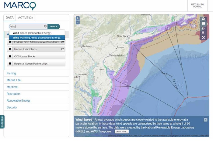
The MARCO Portal is the most robust 2D-mapping tool to date developed using Madrona. It integrates a number of data layers published by ESRI, NOAA, The Nature Conservancy. In addition to our typical ArcGIS, Arc2Earth and OpenLayers data publishing workflow, this project takes advantage of up and coming tools and technologies including Tilemill, Tilestache, Knockout JS, UTF-grids and more. A number of new Madrona modules were also developed as part of the project including the Layer Manager and Data Catalog.
Read the full blog post from Ecotrust developer Scott Fletcher on the MARCO Portal Project Log
blog comments powered by Disqus